Total Distance:- 23.8 Km (14.8 miles)
Ave Speed:- 3.60 Km/Hr (2.24 mph) [10.09 am – 16.48 pm ]
Max height:- 307 m (1010 ft)
Total ascent:- 644 m (2112 ft)
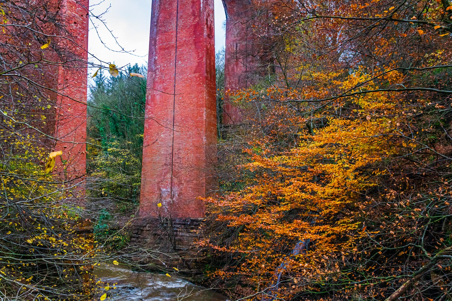
Charles led, 7 in group. Leaving the coaches at the Cross Keys pub on the A171 on a rather overcast but dry morning, we initially headed south to the route of the disused railway line. From there we headed east on an excellent path through Pinchinthorpe, where we had a coffee stop, and on to Hutton Gate. Taking a track heading SE through Bousdale Woods, we then joined the road heading to Hutton Village. Just before reaching the village we turned off the road onto a track which swung around to a southerly then SW direction through Hutton Lowcross woods. Leaving the woods, we headed ENE on good, if somewhat wet, paths across the wide open moor, eventually arriving at Highcliffe Nab. As ever, even under the grey skies, there were excellent views over the woods to Guisborough and beyond, especially to the east. At first, I couldn’t believe that we were still only level with Guisborough and not further east! Our route then took us along good paths/tracks on the Cleveland Way through Guisborough Woods during which we found a good spot to stop for lunch. Reaching Spa Wood, we had a pleasant walk through the trees and the fallen leaves while descending to the A171 at Slapewath. Crossing the A171 near the pub (Charles refused to take us in for a second lunch!!) we left the Cleveland Way and headed NE along the Cleveland Street footpath. It has to be said that this was not as good as the Cleveland Way as the recent heavy rain had made the footpath very muddy. Charles was certainly not gaining brownie points at this stage, although it is fair to say that there were probably very few paths free of mud on the day. Passing to the north of Boosbeck, we reached the minor road heading into Skelton Green. At this point, Charles put on a loop heading on a footpath towards N Skelton and then returning westwards to the outskirts of Skelton Green. It became obvious that Charles was now endeavouring to build up his brownie points as we were walking on good solid surfaces. Things improved further as we rejoined the Cleveland Way and headed into Skelton and through the streets of a housing estate. After crossing the A174, we descended into the woods alongside Skelton Beck and crossed the beck beside the viaduct carrying the railway line. This area was quite attractive with yellow leaved trees on both sides of the beck. There was also an additional point of interest in that a workman was suspended from the top of the viaduct apparently making repairs. As we continued on the Cleveland Way I was surprised that the footpaths were in such good condition. It might have been expected that following the recent bad weather they would be in the same condition as the Cleveland Street footpath but this path was much better. As we headed to the mouth of the dene in the fading light, we lost the shelter of the trees from an increasing wind. At the sea front, the wind was whipping up the sea and we were grateful for the nearby Ship Inn and the adjacent coaches.
A good walk with the exception of the muddy bits in the middle. Excellent views from the Cleveland Way above Guisborough.
To see the route (red line) click here
To see the photos, click on a photo and move forwards and backwards using the <> keys.