Total Distance:- 24.42 Km (15.2miles)
Ave Speed:- 3.61 Km/Hr (2.24 mph) [9.20 am – 16.06 pm]
Max height:- 120 m (394 ft)
Total ascent:- 540 m (1771ft)
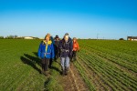
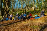
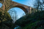
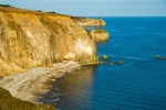
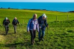
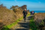
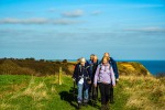
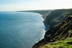
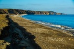
Peter led, 9 in group (only 2 long walks as Ian led a short walk due to the absence of another leader for that distance). Leaving the coaches on the slip road of the A19/A182 junction, we headed east to South Farm before turning south on a reasonable path along the side of fields. Unfortunately the last field had been ploughed right to the edge so that made for difficult and slightly muddy going, although due to the cold temperature the mud was fairly firm. This brought us out at Hawthorn and spotting a signpost for Hawthorn Wood followed that for 100 yds along the road before realising that it wasn’t the path I wanted. A bit further through Hawthorn, I found the path I had marked as my route, at least it followed the route I had marked but most people would struggle to call it a path. Suffice to say I will follow the signpost next time. Anyhow, we struggled past shrubs, fallen trees etc and then after re-crossing the Hawthorn Burn, the path became slightly better before joining a good track which we would have been on had we followed the signpost. Although, looking at the map, this is mainly outside the dene. At the mouth of the dene, my route took us under the railway viaduct and along the beach (marked on the 50,000 map) With the tide in, there was no way to follow this route and John reckoned where it came out involved a very difficult/dangerous climb. No wonder I do not like walking in Co Durham. Anyhow, we climbed out of the dene and headed south alongside the railway line on a good path. Opposite Beacon Hill there is a path marked along the cliff top, however after about 500 m this was closed and we had to make our way back to the path alongside the railway. We continued beside the railway until Easington Colliery where the path went back to the cliff top and then along both sides of Horden Dene Soon after, we had a lunch stop sitting just back from the cliff top with good views along the sunny coastline. About 1 Km further south we descended to the “beach”, which consists of black deposits of various minerals and other materials. What a difference to the real beaches we had walked along in Northumberland 6 days earlier. Anyhow, we continued until we reached the mouth of Castle Eden Burn where we headed inland through a housing estate at Blackhall Colliery. A good tarmac path then took us down to High Hesleden from where we went along the road to the edge of Hesleden and thence north along the edge of a field. Here I committed the cardinal sin of looking at my map while walking on an uneven surface. Measuring my length on the ground, my only thought was my new expensive camera which while hitting the ground, did not take my whole weight – fortunately it seems to be OK. On my feet again, we had an afternoon tea stop to get my breath back and then we descended into Castle Eden Dene. A good path took us WSW thro the dene but unfortunately the low sun ensured that the scenery was quite dark which did not show the sheer rock faces to their best advantage. Climbing out of the dene, we accidently by-passed the castle as the path to it was not obvious and then we reached the impressive church where Mr Moat was equally impressed with the visible moon next to the church spire. After crossing the B1281, a footpath heading SSE then brought us to a dismantled railway line which we joined to head WSW to our destination, the Castle Eden Inn. An eventful walk, some of it good, other bits not at all good. The overall saving feature was the excellent sunshine which made up for our previous visit during which it rained all day.
To see the route (red line) click here
To see the photos, click on a photo and move forwards and backwards using the <> keys.
